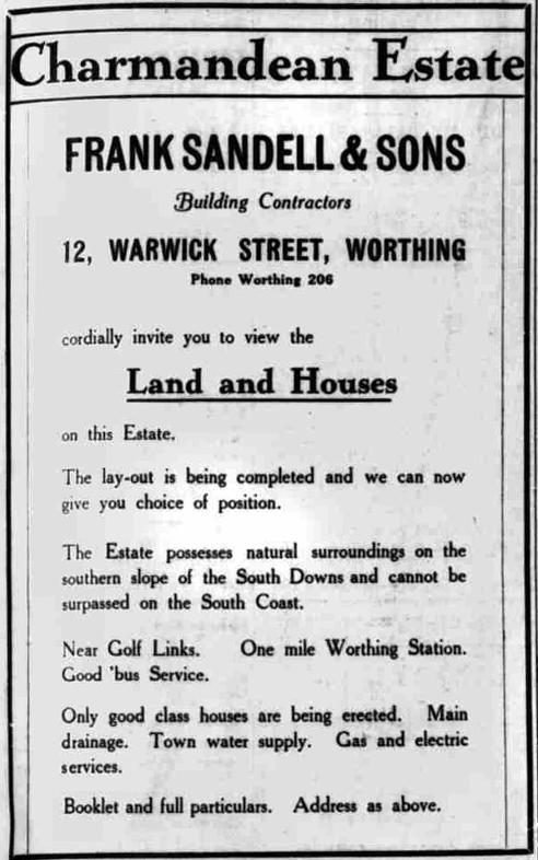
Development of the southern slopes - 'The Avenues'
On 1st Feb 1927, part of the southern slopes of the Charmandean estate was sold off by the executors of Thomas Dyer Edwards of Charmandean, to Frank Sandell & Sons, a well known local building firm, for £15,650, who started building and planning First, Second, Third, Fourth and Fifth Avenues.
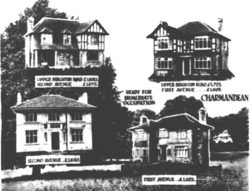
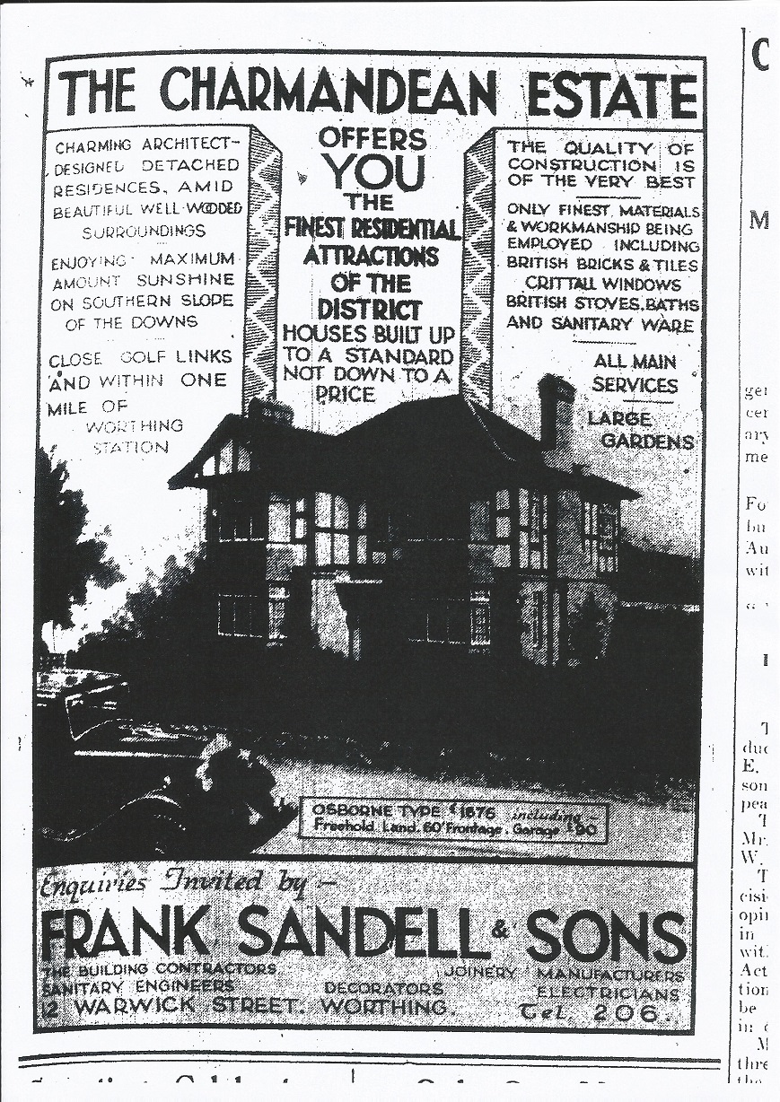
Our research has found fantastic articles such as the below, which is an extract from one c.1932, showing a variety of the house styles originally found in the 'Avenues'
Further information can be found on the 'House Adverts and Articles page'
Clockwise from top left, examples: No 1 Second Avenue, and Upper Brighton Road, No 10 First Avenue and Upper Brighton Road, No. 3 Second Avenue, and No. 14 First Avenue:
[Citation: Worthing Herald, 1933, British Newspaper Archive, extract of]
'The Avenues' - the story
This first section shows articles from the Worthing Gazette and Worthing Herald, advertising the estate and also the houses built. They are in chronological order, and we can see how more different styles were added over time.
The adverts shown here are of general Charmandean interest; but we have found many articles over the years which may be specific interest to an individual house owner for their own house. For this reason, we have set up a 'House Adverts and Articles page' for those readers who would like to know more than just the general history on this page.
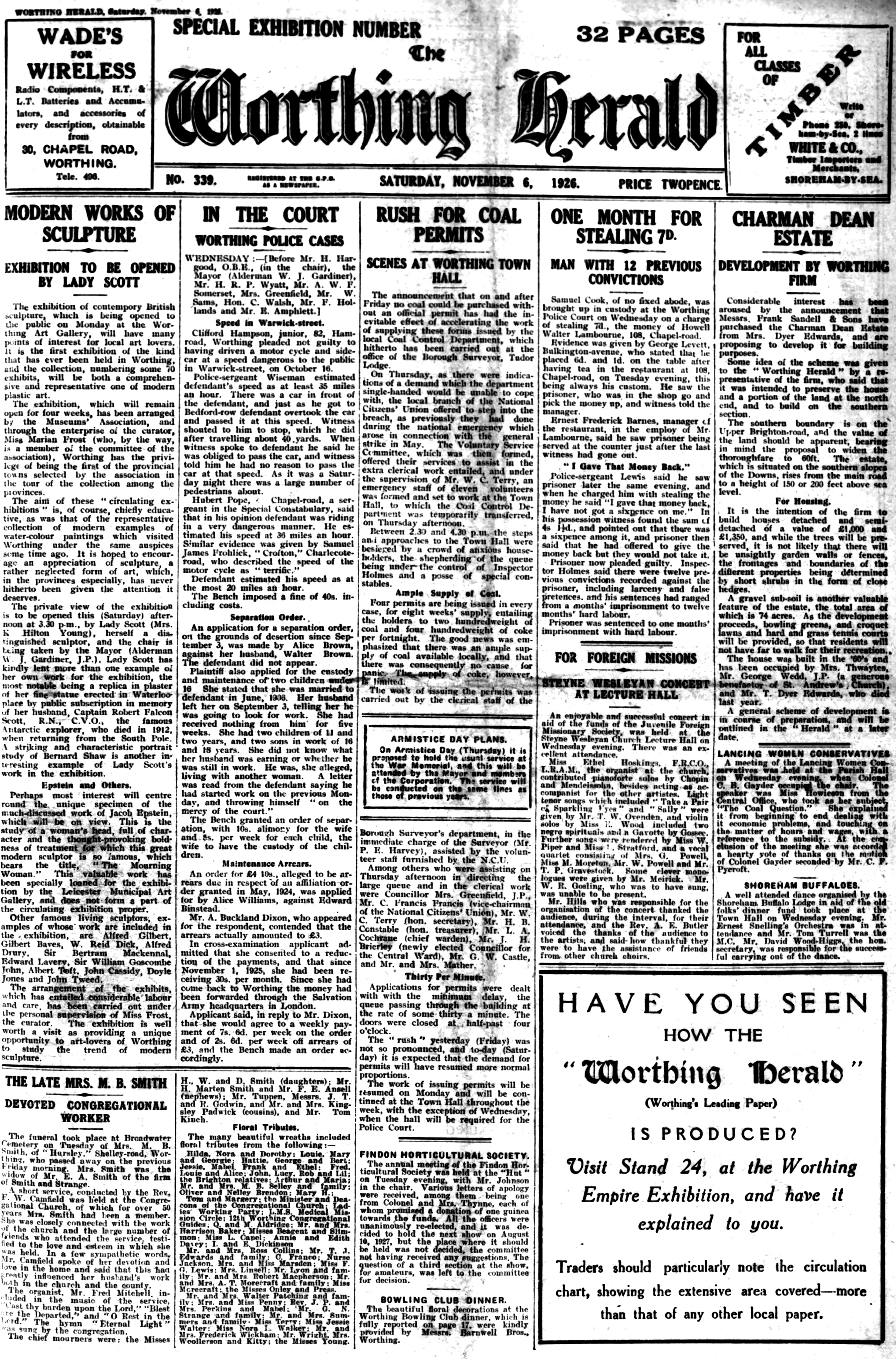
'The Avenues' story starts when the Estate was sold by Mrs Dyer Edwards, presumably the decision being prompted by her husband's untimely death in Naples earlier in 1926.
Although the legalities of the sale of the Charman Dean Estate took place in Feb 1927, the offer for sale was made public, being in the Worthing Herald, Saturday November 6th, 1926.
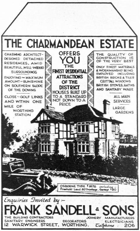
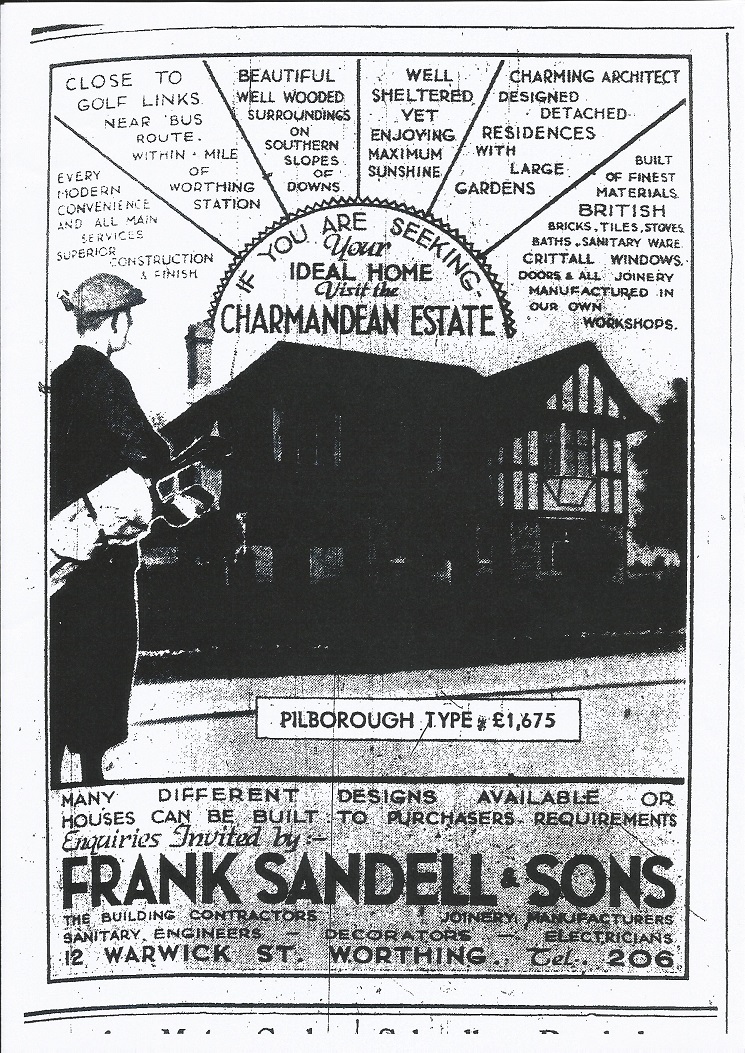
One of the original newspaper adverts from c.1932 advertising the Estate, this one being in First Avenue for the 'Osborne' type house.
From the date of the advert, we believe this might have been an advert depicting No. 10 First Avenue.
At this point, more choice of designs for building were available and this is shown in later adverts.
The progression of development
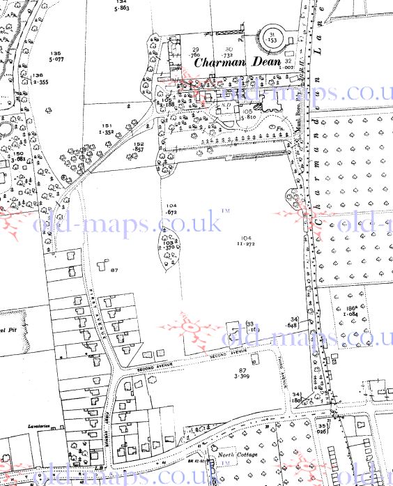
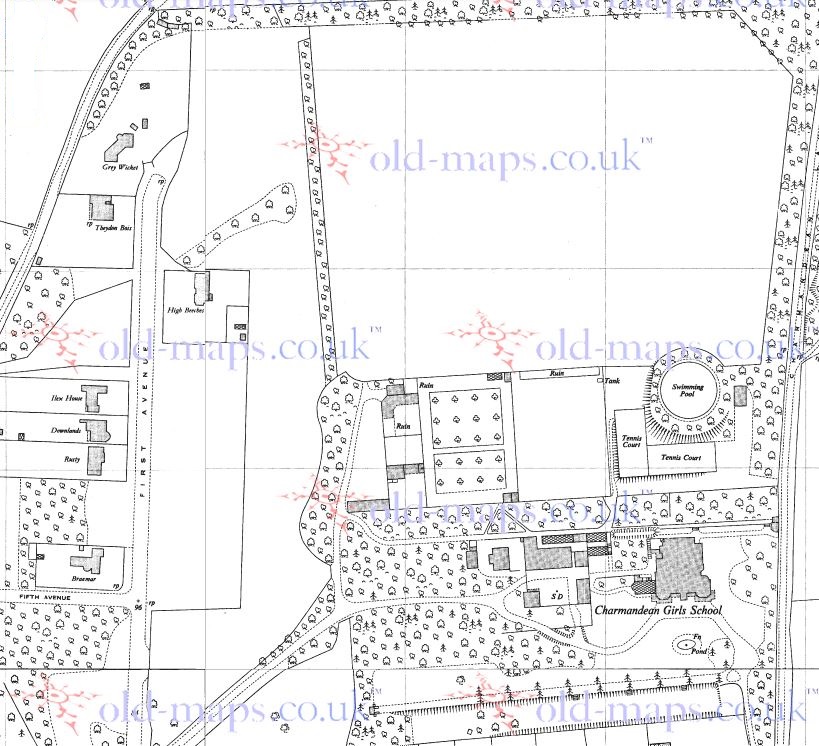
An old map from 1932, showing building starting in the South-Western corner of the Estate.
This is interesting as, around this time (c.1933), the house featured on our page 'Building in Charmandean' shows photographs looking out over the Open Space, and with Fourth Avenue plotted out, but no houses built yet.
We can see from this map the continuation of the tree line West-East by the now-entrance to Longlands, before First Avenue was extended Northwards, and now that the 'West' driveway to Charman Dean utilises First Avenue until it rejoins it's original path where the junction of Longlands is now.
Citation: www.old-maps.co.uk, showing Worthing
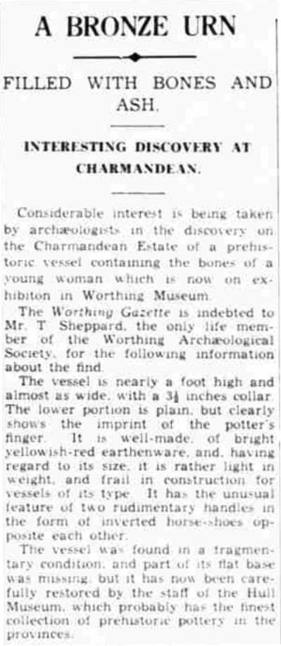
The 'Charmandean Open Space'
In c.1936 the building firm who, amongst other firms, were developing the Estate, Frank Sandell & Sons, offered 5 acres of land on the north side of Second Avenue to Worthing Borough Council, 'for use as a public open space so long as football and cricket were banned'. See 'Charmandean Open Space' page for more information.
Citation: Worthing Sentinal / Worthing Herald.
The 1950's..
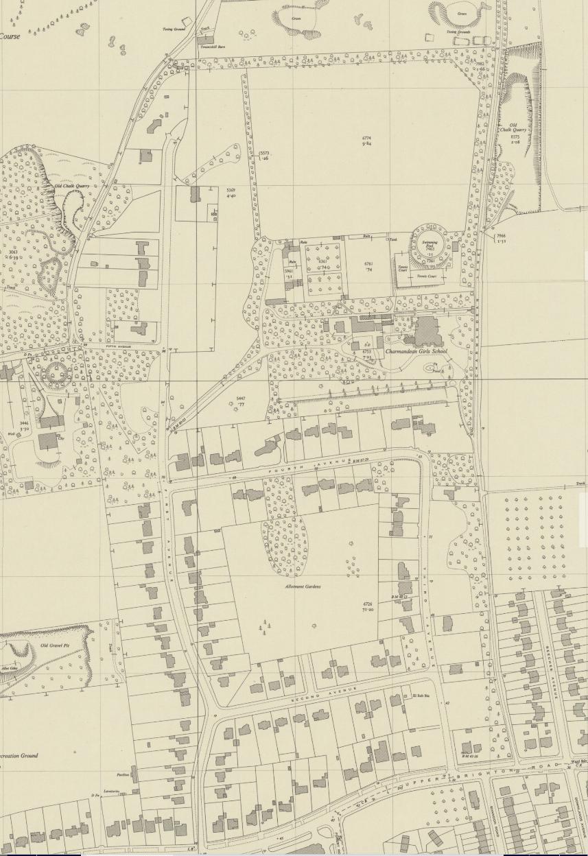
Development progressed over the years, and the 1954 OS map below shows a number of important features at the time:
* First Avenue had been continued North, with Fifth Avenue created through to Hill Barn Lane (before this, Hill Barn Lane just turned North to Tenant's Hill Barn as there was no vehicular entrance to Charmandean Estate)
* The Charmandean Girls School was still present in it's 30 acres of remaining land
* The Charmandean Open Space was marked as 'allotment gardens'
* Beeches Avenue had only been developed half-way
Citation: Map source: National Library Of Scotland Maps, https://maps.nls.uk/
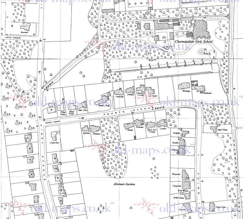
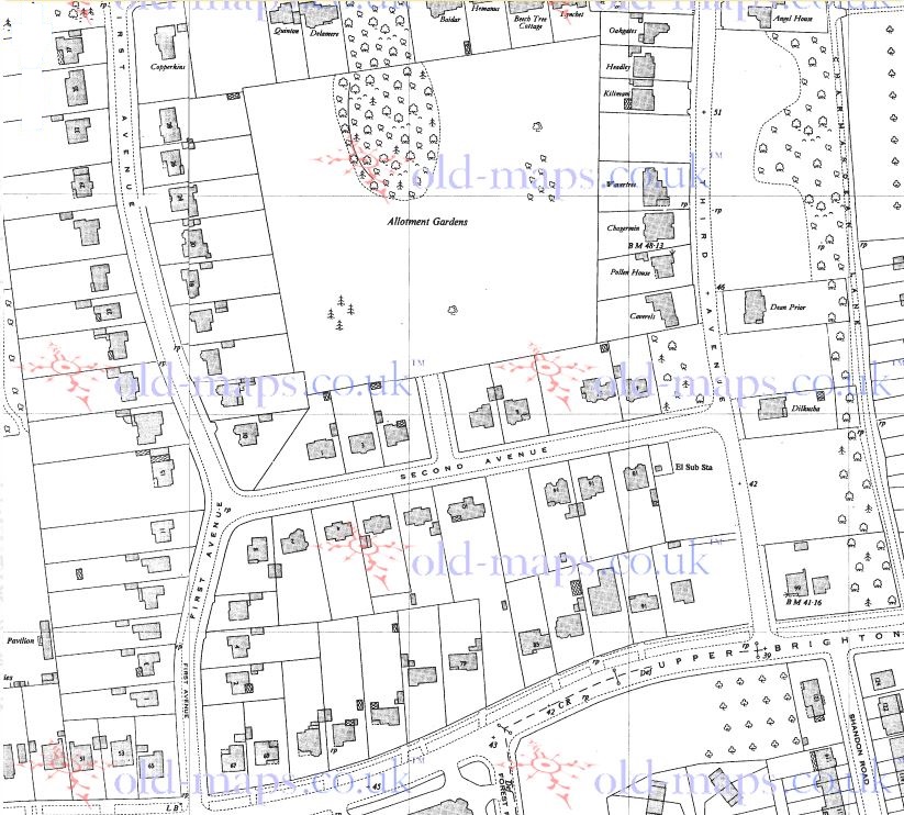
This site originally included the below maps from c.1953, which displayed some house names, so they have been kept on here for reader's interest. (click to enlarge)
Citation: www.old-maps.co.uk, showing Worthing
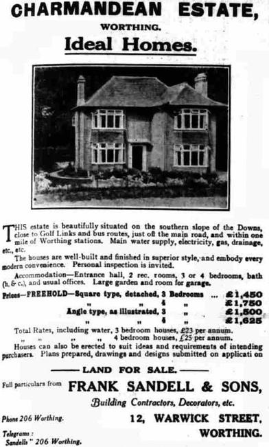
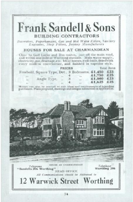
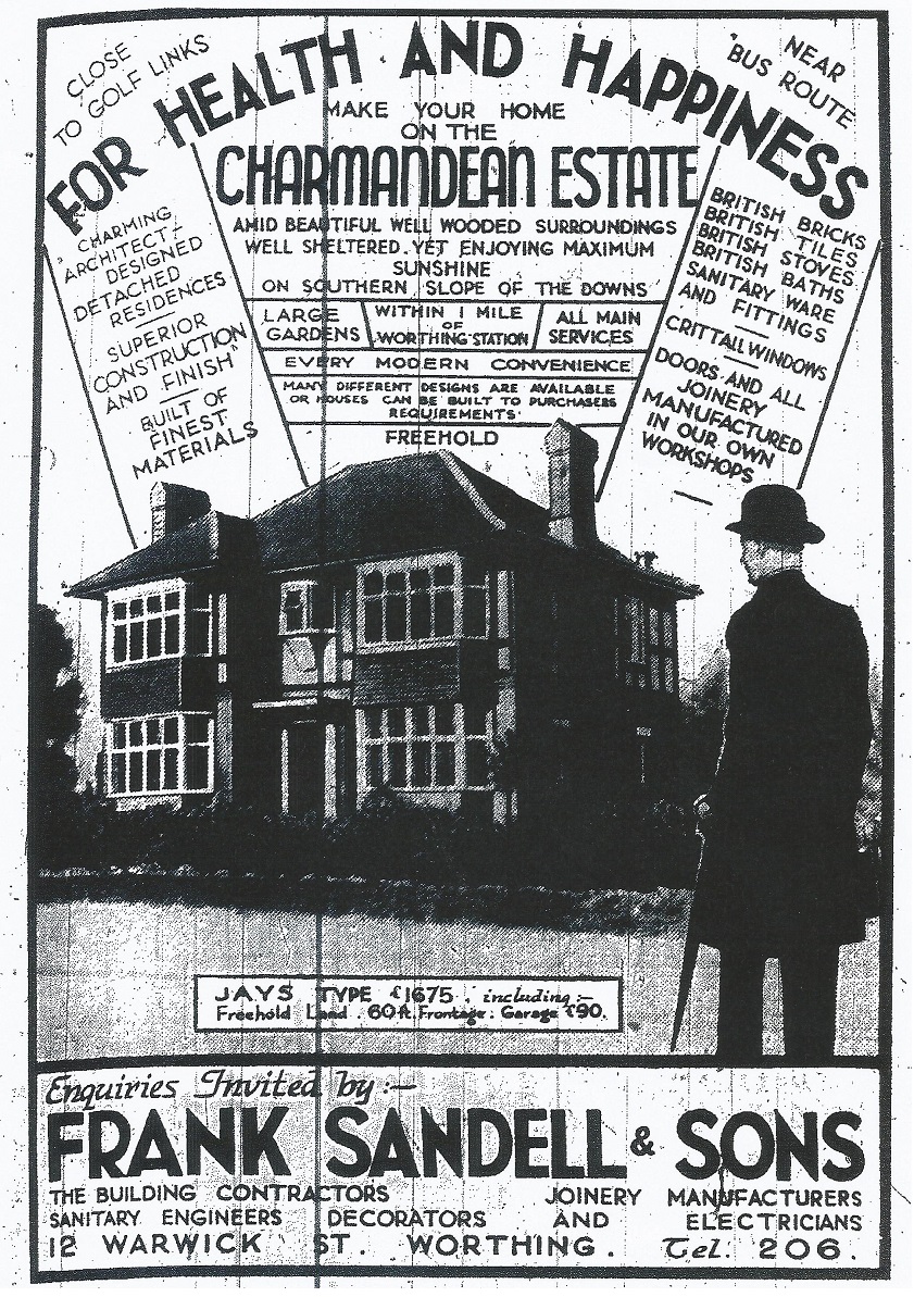
The house adverts we have seen in the local press were correct, 'Architect Designed residences' - on initial glance it appears some houses are the same, however we believe each one is subtly different, however all the early designs from 1929 follow the same 'Arts and Crafts' style of building design as previously mentioned.
Not all came with garages, in 1929 a garage was an extra £90!
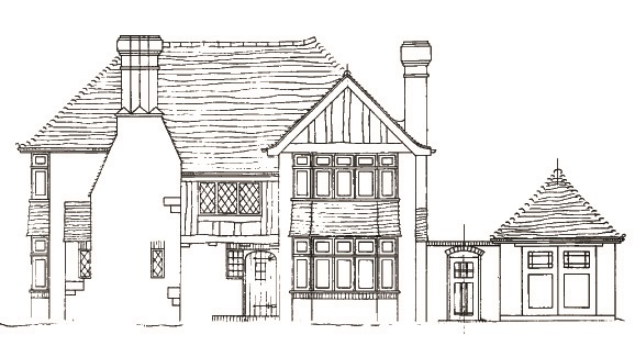
Left is an advert for one of the houses in Charmandean, which has been kept with the house over the years.
(It is the same house as in the blueprints above).
Thank you to the owner for contributing this to the site.
Note that there were 4 main styles of house at this time noted on the advert;
Square type, 3 or 4 bedrooms, and Angle Type with 3 or 4 bedrooms.
The prices were between £1,450 and £1750!
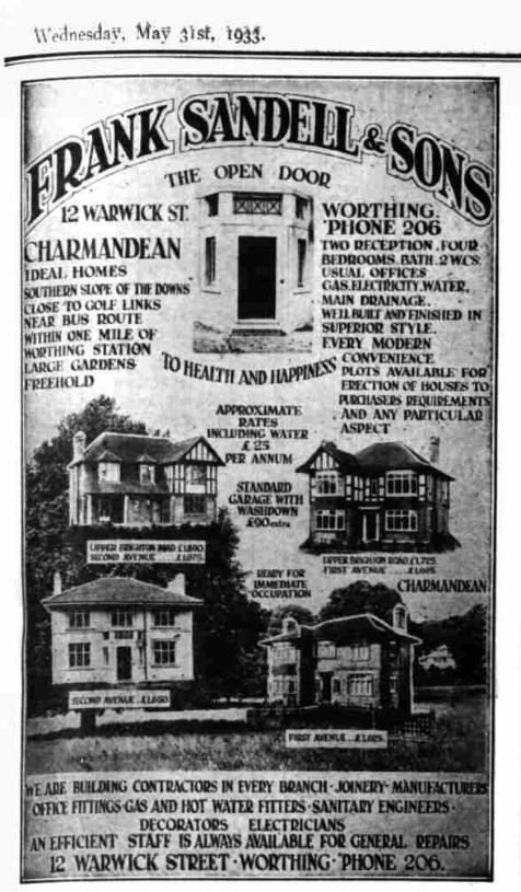
A selection of adverts from the Worthing Gazette during 1934 (click to enlarge).
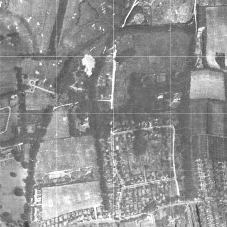
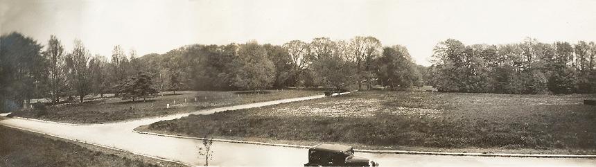
An early aerial photo of Charmandean Estate taking shape, post-war, c.1945, with still much of the upper part of First Avenue yet to be developed.
The wooded section on the Eastern side of First Avenue, opposite the entrance to Longlands, was not developed at all until the late 1980`s.
:
The war years
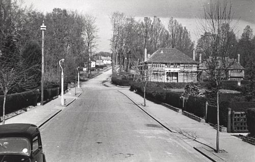
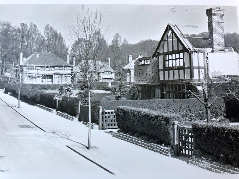
The below photo is from the West Sussex Past Project and c.1944, it is looking North up First Avenue with Fourth Avenue on the right; the house with the scaffolding was owned for many years by Mr Dunhill of special tobacco pipes and luxury goods fame. See famous residents section.
We can see where the tree line in the centre of the photo was broken through to continue First Avenue northwards (one can tell from the shape of the trees).
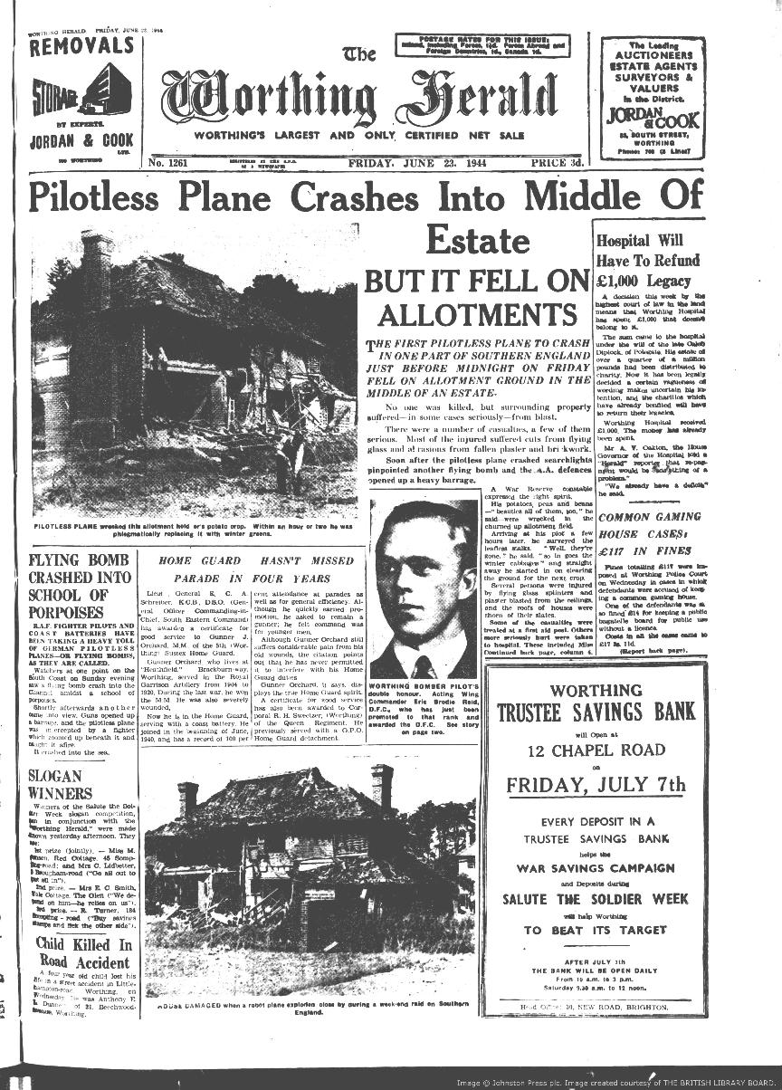
Further historical facts have now come to light about the flying bomb and the aftermath, so this section has been updated. History research is always evolving!
We originally thought the house with the scaffolding was being built, the timeline didn`t match. Due to new information we believe that the house was in fact being repaired after the flying bomb decimated a house on the right (out of photo, but you can see the Oak gates symbolic of many Charmandean residences at the time), and badly damaged many more.
Flying bomb
Our research previously uncovered a number of individual stories, which we believed could all be related to an incident during the war when a flying bomb landed in the Charmandean Estate (we believe this was the only flying bomb to land on Worthing).
Due to collaboration between Charmandean residents researching dates in their deeds, and some further research in newspaper articles from the time, we have managed to pinpoint the date of the awful night.
As the following articles show, just before midnight on Friday 16th June 1944, a German flying bomb landed in the North-West corner of the Charmandean Open Space (which was being used as allotments at the time for the war effort). It affected residents including the following:
- Miss Rose Watts, living in Fourth Avenue in 1942, was the Honorary Secretary of the Worthing Branch of the 'Bible Flower Mission'. It was set up for reasons such as delivering lavender to patients in London hospitals during the war period, and she had done this since war broke out.
- Mrs Florence Gates was living in Fourth Avenue
- Mrs Kate Buss was living in First Avenue (we believe)
- Mr & Mrs Coleman (wife, Florence)
Then, their lives changed.
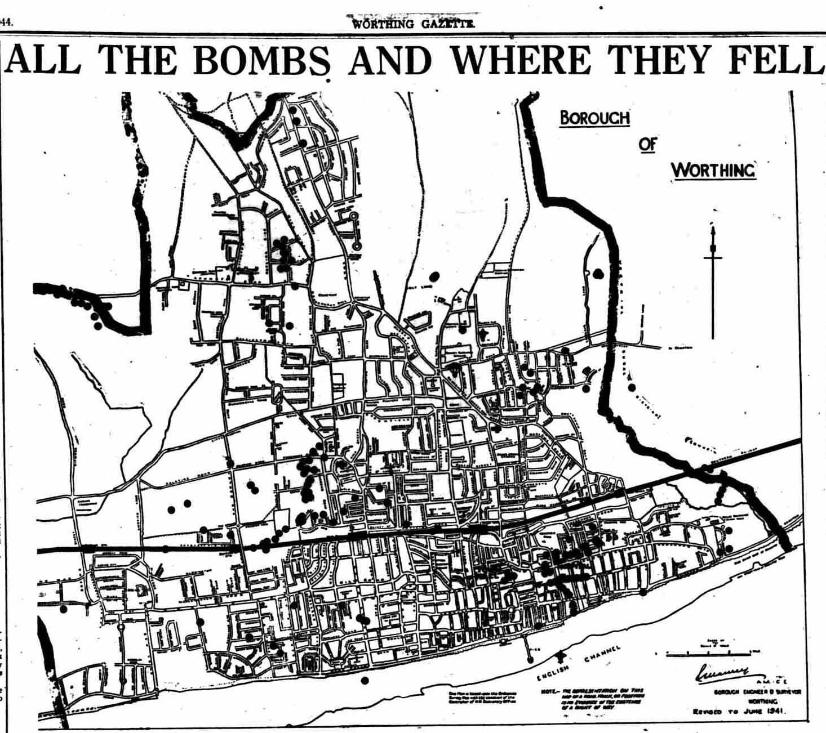
The below extract from the Worthing Herald, 11th October 1944, clearly shows the flying bomb landing site as the North West corner of the Open Space:
Where did the flying bomb fall?
This aerial image of Charmandean shows approximately the area detailed in the bomb damage article below:
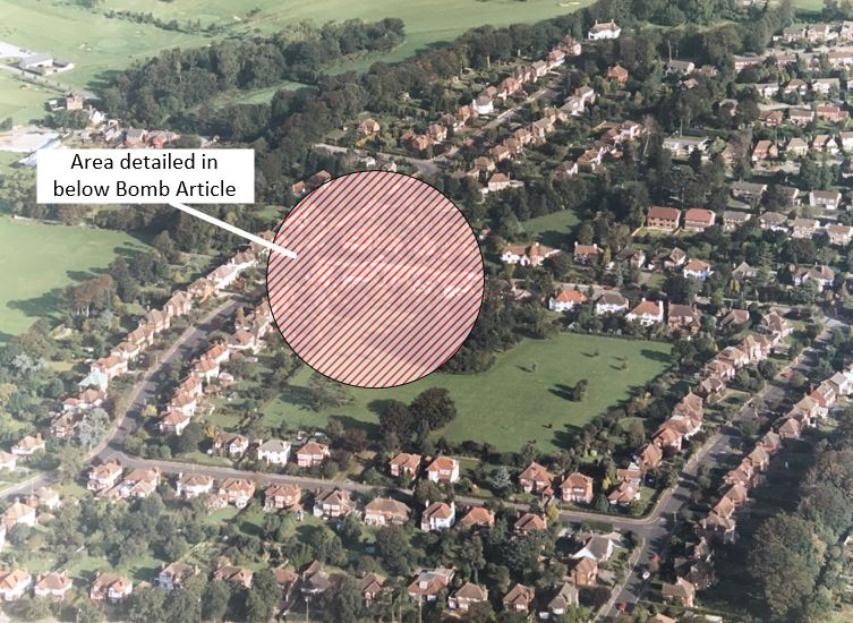
Detailed Bomb Location and Damage radius
The below detailed map is a 'best guess' judging by historical information; we know it landed in the Charmandean Open Space (allotments at the time), and judging by research some houses were damaged more than others.
The 'damage radius' map below collates information and historical facts currently known on this event; some items are numbered and further details below.
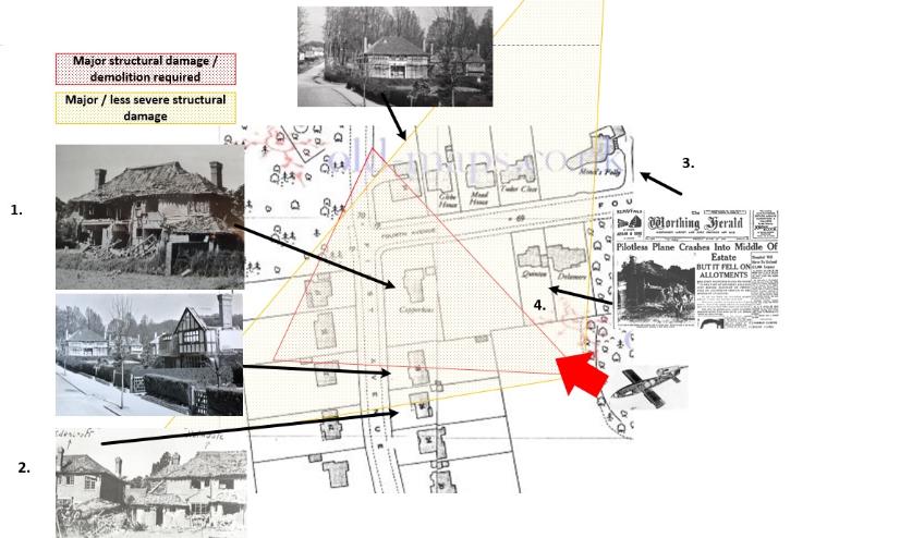
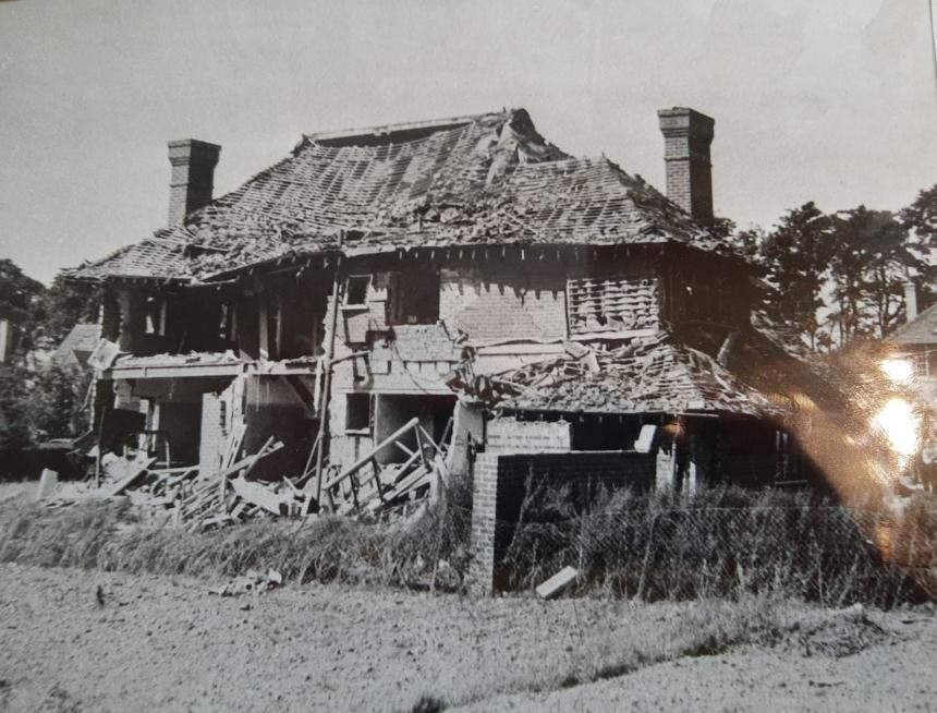
1. This house, on the corner of First Avenue and Fourth Avenue, we believe was so badly damaged it had to be demolished and rebuilt.
Prior to new historical information recently known, we thought this house hadn`t been built by June 1944, however, it seems it previously was, but in the late 1944 photos, missing because it was demolished before rebuilding in the same style and design.
We believe this was the only house so badly damaged it had to be demolished; others with damage were repaired.
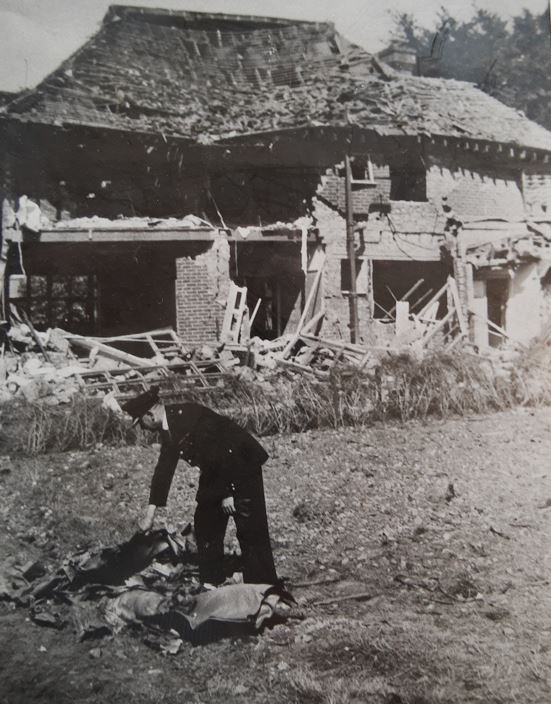
2. Both of these houses in First Avenue suffered damage, to different extents.
3. 6 houses away from the most devastated house, on the North side of Fourth Avenue, Mrs Gates had to move out of her bomb-damaged house into temporary accommodation in Railway Approach. We believe the reference to the 'Italian made windows which cost £500' (now c.£22,000 in today's money) related to a house on the North side of Fourth Avenue damaged by the blast; this is referenced in the newspaper article below.
4. Mrs Kate Buss, who was previously seriously injured in the attack and taken to hospital, was asked by the Mission to take over the secretary-ship of the Bible Flower Mission (presumably after Miss Rose Watts of Fourth Avenue, died of her injuries), and they continued to send up 'thousands of 'lavender bags' with holder on which is written a text from 'Gods word' to the patients in the London hospitals, who love them; there is a quantity of lavender in Worthing and I should be glad of gifts of same, shredded if possible''

|
BL_0001920_19440623_001_0001.pdf Size : 921.217 Kb Type : pdf |
|
|
BL_0001920_19440623_271_0016.pdf Size : 1231.802 Kb Type : pdf |
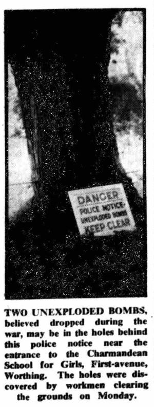
Bomb Disposal Unit Called
The Worthing Gazette reported Weds 1st September 1948,
'two 12-inch circular holes believed to be made by unexploded bombs were found on Monday by workmen in a field near the drive leading to Charmandean School, Worthing.
Police were informed and arrangements made for a bomb disposal squad to visit the site.
A flying bomb exploded near the spot during the war and other bombs fell in the neighbourhood.'
'Charmandean Drive'
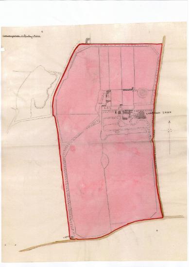
The late 1800's West driveway for Charmandean House ran from the Upper Brighton Road, & at the entrance was a lodge mentioned in the 1900 Convenyance map on the right.
This is referred to as the late 1800's driveway, as pre late 1800's the Western driveway was directly through the middle of the estate (i.e. through the Charmandean Open space as it is today), shown on this map as a single line from the Upper Brighton Road.
See more on this in the Maps and Photos page.
When the houses in First Avenue were built, they were built on the East side of the original 1800's driveway, and residents have said in dry summer months sometimes the remains of the original driveway can be seen in their back gardens. More information on this in News.
When 'the Avenues' were developed, and First Avenue constructed, this became the driveway for the school, only forking off East towards the house where the entrance to Longlands is today, and re-following the original driveway.
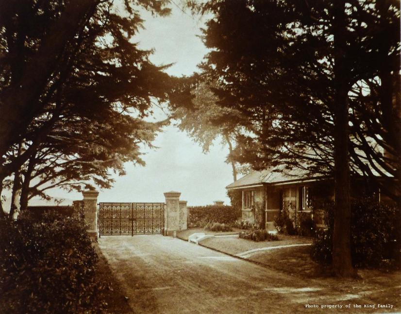
Charmandean Lodge
Thanks to the family of Alfred King, who's great-great niece contacted us and allowed us to share her family's photo album of Charmandean, we now know what the lodge looked like.
The lodge was described in the 1914 Sales Particulars as 'Picturesque Lodge, which contains parlour, kitchen, three bedrooms, store house, W.C, etc, and gives entrance to a broad well-kept drive, nearly half a mile in length screened be forest trees and a shrubbery border'
Further information on who might have lived in the Charmandean Lodge can be found in the 'People' page, and detailed in the census records for that time - for example, in early 1900's when Charmandean was owned by Alfred King.
The lodge was demolished during the widening of the A27, and was located in the South-West corner of the estate. The entrance drive (the West Charmandean entrance) was next to the lodge, and today, would have run South-North in the gardens behind houses in First Avenue. For more information on the Charmandean Gateposts, see Charmandean House page.
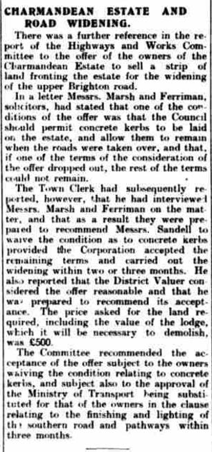
As this article from the Worthing Gazette, Weds 3rd August 1927 shows, the council wished to widen the A27, and as such, required demolishing of the lodge (and the West Entrance gateposts).
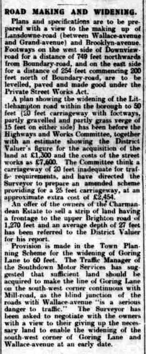
In November 1927, 'an offer of the owners of the Charmandean Estate to sell a strip of land having a frontage of 1,270 feet and an average depth of 27 feet has been referred to the District Valuer for his report.'
In March 1935, it was reported 'under road traffic act 1934,the effect of which will be that the following roads which at present are not roads in a build up area for the purposes of the Act shall be subject to a speed limit of 30 mph: Charmandean Lane, Hill Barn Lane, Second Avenue, Third Avenue, Fourth Avenue.'
(at this time, the Avenues were not made up as tarmac, and just rough tracks as not adopted by the council).
The below article also refers to more detail on the subject.
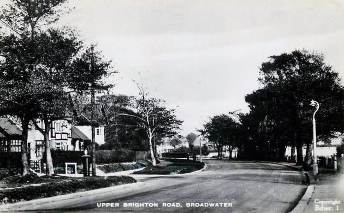
Upper Brighton Road
We believe this fantastic photo to be c.1947.
The entrance to First Avenue can be seen on the left, and the post box!
Note the oak gate on the residence on the corner of Upper Brighton Road and First Avenue; many houses in Charmandean were built with this style of gate at the time.
Citation: Postcard of Upper Brighton Road, Broadwater
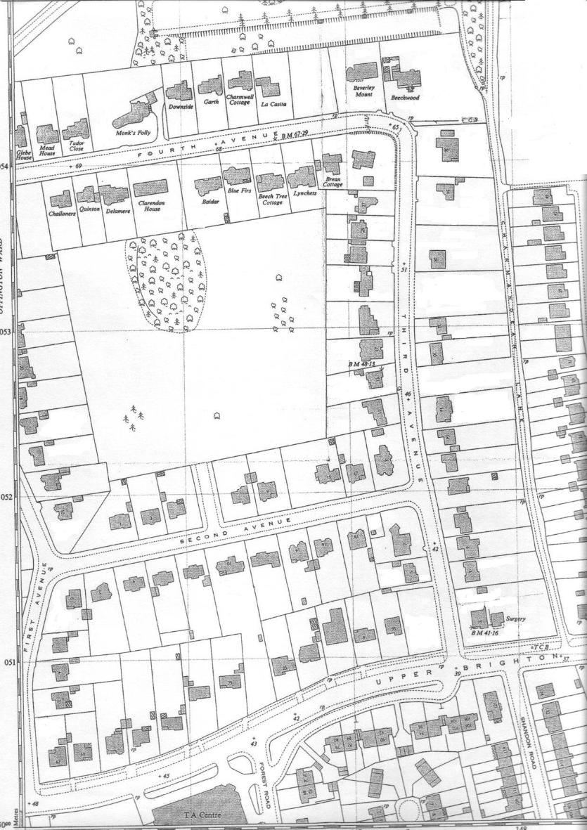
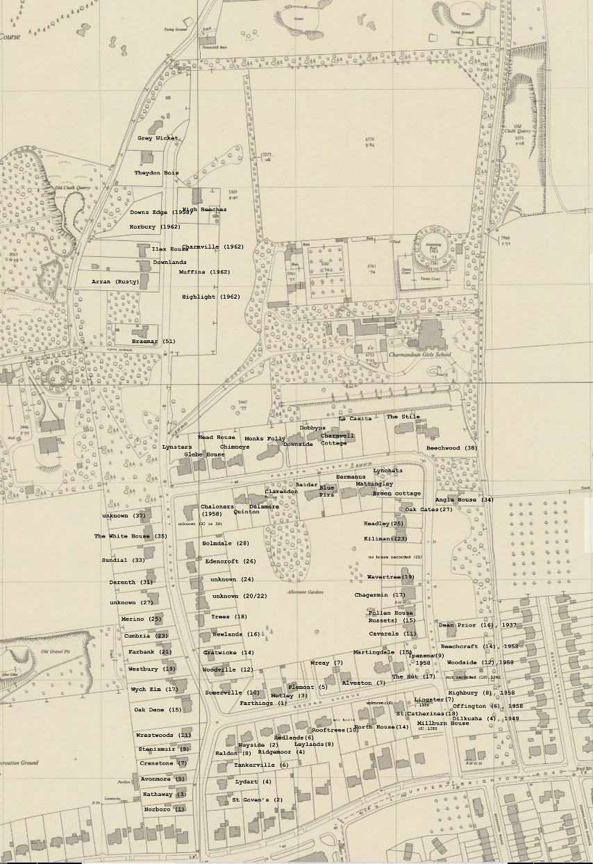
A interesting map from c.1959, showing Upper Brighton Road, partial First, and Second, Third and Fourth Avenues.
Longlands had not been built yet (another 4 years) and the East and West Entrances and driveways of Charmandean House are just visible in the top left and right corners.
The Development of Longlands
The development of Longlands story can be read in the 'Longlands' pages.
In brief... the story reached national headlines, as the Yorkshire Today newspaper reported after Charmandean Residents bought the land to apply strict convenants on it, the land was then sold on to a developer (1963?) for £70,000, with the provisio that it should be developed with 71 3/4 bedroom luxury homes selling for up to £10,000 each.
The total cost of the scheme was estimated at just over £500,000!
Citation: www.yorkshiretoday.co.uk
http://www.yorkshiretoday.co.uk/mk4custompages/CustomPage.aspx?sectionID=4961
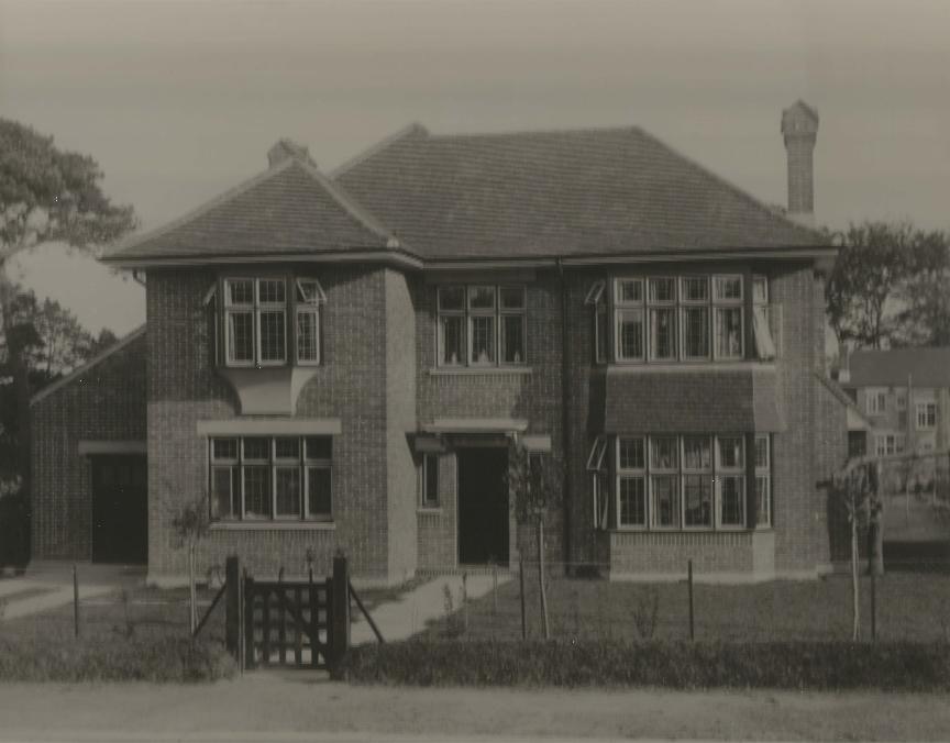
Second Avenue
Thank you so much to the resident for allowing us to share this; a house in Second Avenue when built. Interesting as you can see the oak gate which many houses seemed to have when built, and the post and wire fences.
This is an example of one of the individually designed houses, different from the c.4 designs which were standard as offered by Sandell & Sons during development. Although 'standard' is not strictly true, as we believe each house has subtle differences - there is only one matching pair we are aware of, being the first ones built in First Avenue.
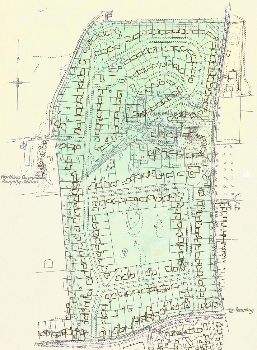
Planning of the Charmandean Estate
The development of the Charmandean Estate can be seen with interest when applying a 2018 overlay onto a 1927 conveyance map, as certain features start to make sense:
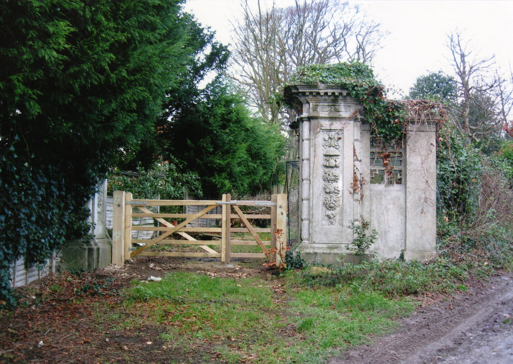
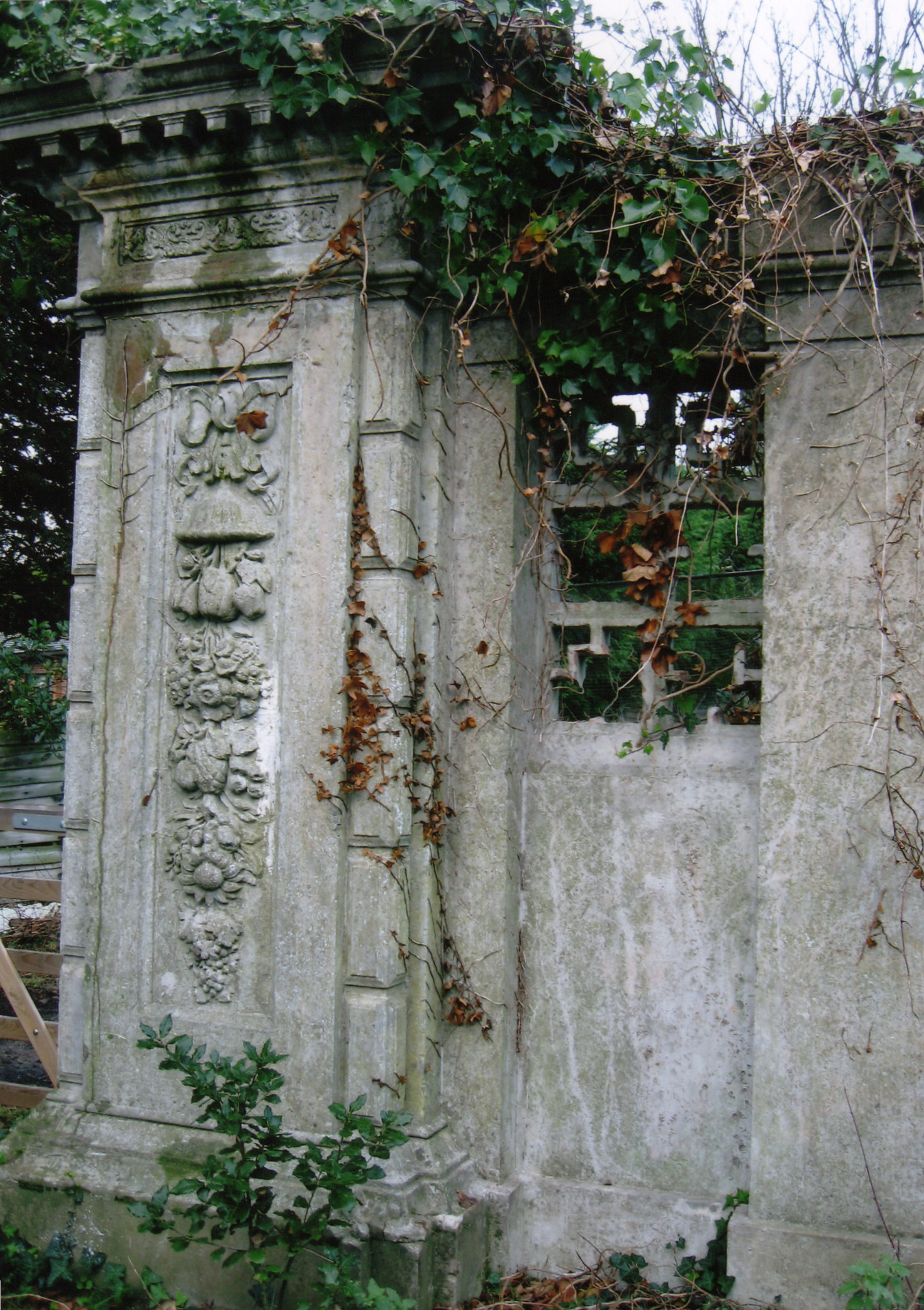
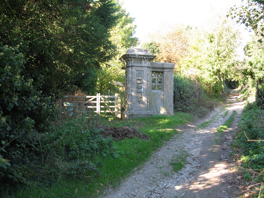
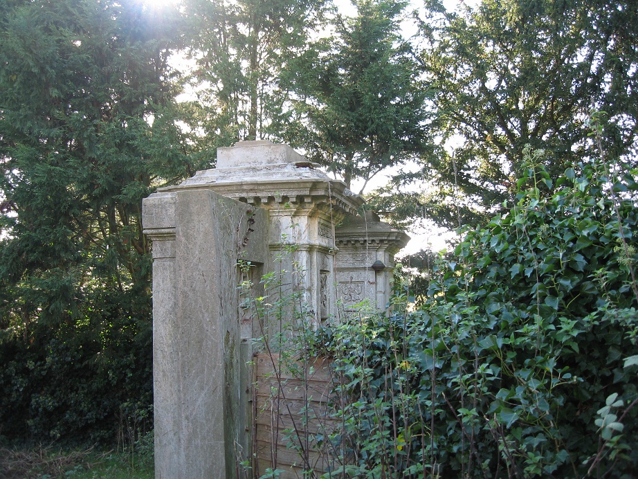
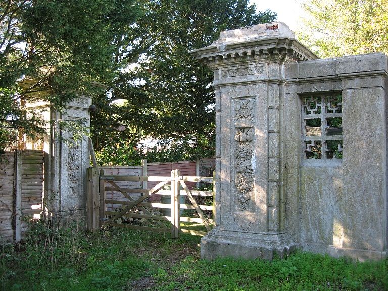
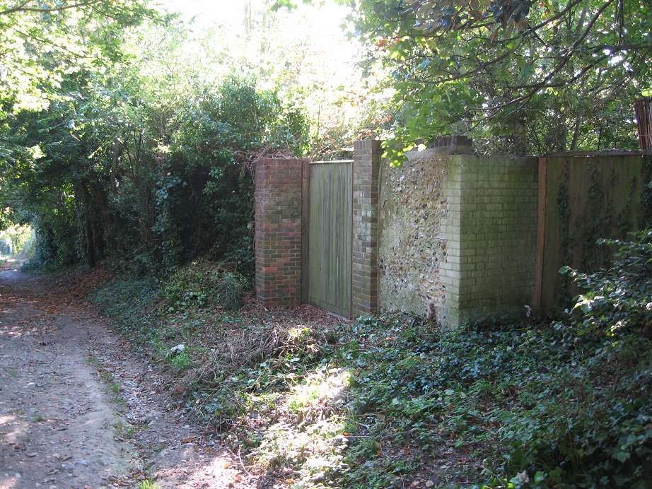
Charmandean East Entrance Gateposts
Even after the House was demolished, and Longlands developed, some features remained until recently; in 2013 the original East Entrance gateposts remained until they were demolished.
For more information on the Charmandean Gateposts, see Charmandean House page.
The Eastern Entrance Gates on Charmandean Lane were a good example of 1800's stone scrollwork/mouldings:
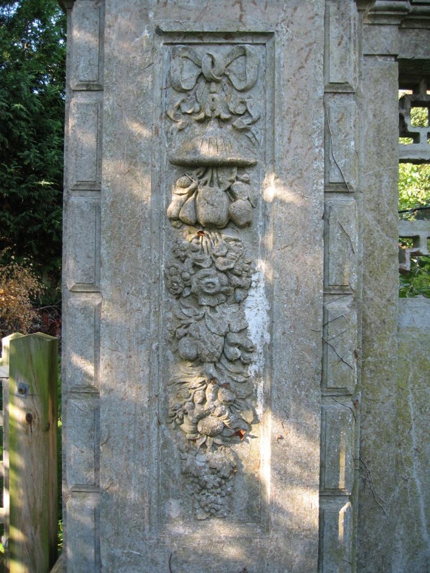
Further photos showing the recently demolished Eastern Entrance Gates in Charmandean Lane:
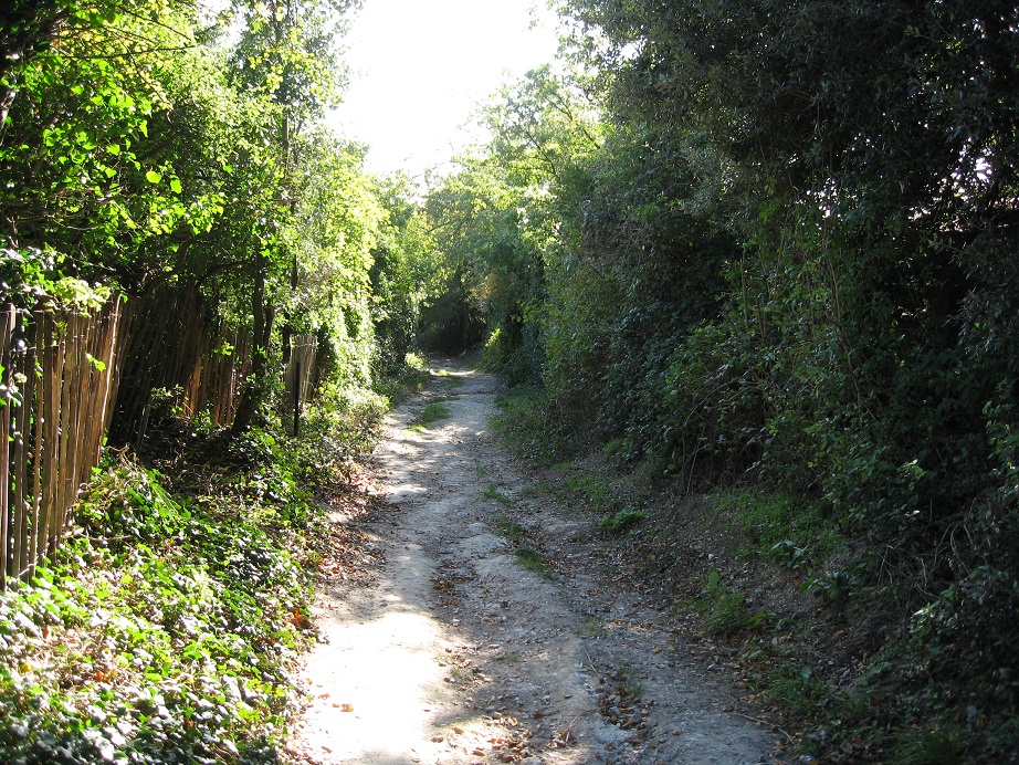
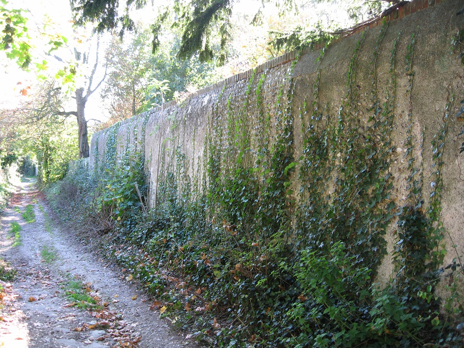
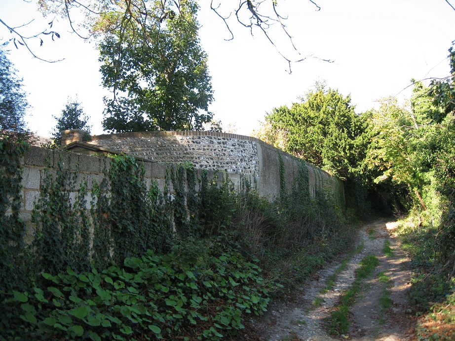
Some sections of the flint Eastern boundary wall are also still standing and run alongside Charmandean Lane:
Charmandean Open Space
During the development of the lower avenues of Charmandean, in 1937 the builders firm William Sandell & Sons gifted an area of land, known as Charmandean Open Space, to the council for 'relaxation and amenities'.
Over the years, there have been a lot of articles on the Open Space, and it hasn`t always been the green recreation area that it is today. We can see from the 1954 OS map, it was marked as 'Allotment space'.
We have documented the history we have found in a new page, 'Charmandean Open Space'

|
Charmandean House Names 1932-1962.docx Size : 19.829 Kb Type : docx |
|
|
Upper Brighton Road for Charmandean History.docx Size : 22.084 Kb Type : docx |
Charmandean from the air
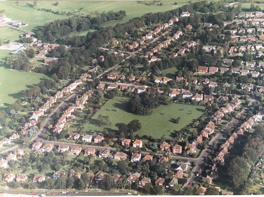
It is only right we round off this first phase of the development of Charmandean with a fantastic aerial photo, taken by a resident (many thanks to the resident for allowing us to share this).
We believe this is c.1989, as the additional 2 houses at the East end of the Spinney are being completed, and the field next to Grey Wicket (top of First) is still present. Interesting for the residents who still remember this!
Privacy Policy | Terms and Conditions | Contact Us | © charmandeanhistory.co.uk
